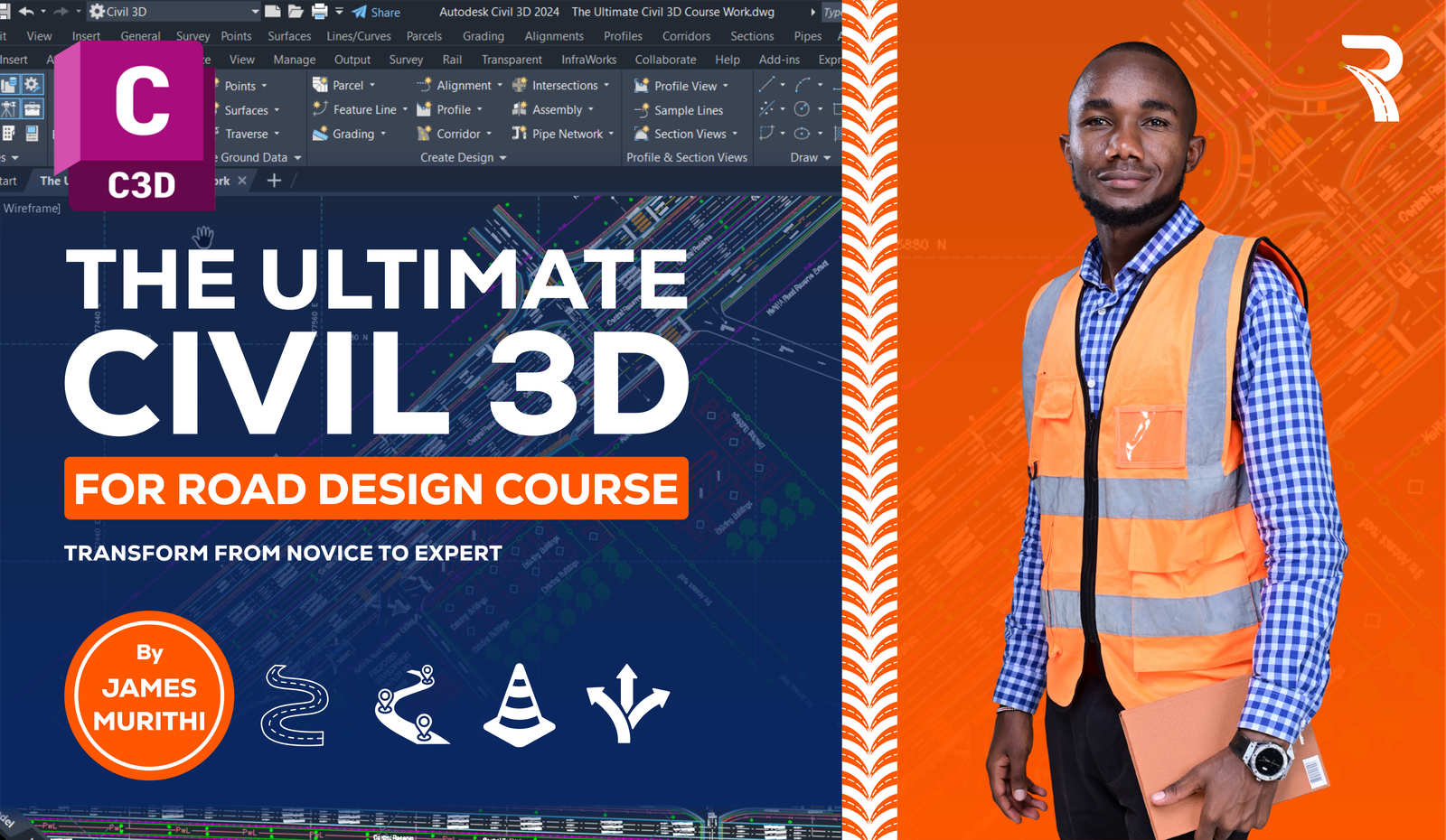
The Ultimate Civil 3D For Road Design Online Course (pre-recorded)
Original price was: $ 75.00.$ 60.00Current price is: $ 60.00.
This is a Certified 2-week self-paced AutoCAD Civil 3D Course, with downloadable learning materials, designed to guide you to an enriching experience and knowledge on applying Civil 3D to real-world projects and delivering results for your employer/clients. It equips design engineers with practical skills to apply engineering principles in the Design of Roads and other horizontal infrastructure projects.
It is a transformative course crafted exclusively for ambitious Highway Design Enthusiasts to be experts in Road design.
Imagine Alex Johnson, a recent civil engineering graduate eager to bridge the gap between theoretical knowledge and practical skills. Under the expert guidance of Highway Design Expert James Murithi, Alex transitions seamlessly from novice to pro, confidently crafting 3D models and functional roadways.
If you are ready to transform your career and embrace the opportunities that Civil 3D offers, then this is your first step toward career advancement by enrolling in our self-paced Ultimate Road Design Course.
On completion, you will earn a certificate shareable on LinkedIn and can be verified online.
Description
This is a Certified 2-week self-paced AutoCAD Civil 3D Course, with downloadable learning materials, designed to guide you to an enriching experience and knowledge on applying Civil 3D to real-world projects and delivering results for your employer/clients.
It equips design engineers with practical skills to apply engineering principles in the Design of Roads and other horizontal infrastructure projects.
Experience hands-on learning with a real-world 6.00km road project, designed to help you apply your skills in practical scenarios by the course end.
It is a transformative course crafted exclusively for ambitious Highway Design Enthusiasts to be experts in Road design.
Course Objectives
- Bridge Theory and Real-world Application with real-world 6 Km Road project
- Master Advanced Existing Ground Modeling and Topographical Analysis
- Develop Proficiency in Horizontal and Vertical Alignment Design
- Integrate Local and International Road Design Standards like AASHTO, and RDM
- Master the art of Pavement Design and Advanced Corridor Modeling
- Perform accurate Civil 3D Quantity Takeoff and generate quantity reports for project cost estimation
- Master industry standards for plan production, data management, and the professional presentation and interpretation of engineering drawings.
- Generate Comprehensive Road Design Reports for project implementation
The Ultimate Civil 3D Course Outline
The Ultimate Civil 3D Interface Tour:
- The ultimate Civil 3D interface guide and key features
- Understanding the workflow and project setup
- Controlling drawing settings
- Accessing Autodesk Help
- Design Templates
- Fundamentals of 2D Drafting-Box Culvert Drafting Project
- Dimensions and Annotations
Engineering Survey:
- Practical Engineering survey procedures and techniques
- Survey data collection and management
- Primary and secondary sources of data such as Google Earth Pro, Global Mapper, and Plex.Earth
- Integration of GIS Technology for Innovative Infrastructure Design.
- Working with survey datasets and Points
Existing Ground Modeling:
- Introduction to TIN Surfaces
- Surface build definitions and analysis
- TIN Volume Surfaces for Earthworks Estimation
- Topographical and catchment analysis
- Creating Topographical Maps and Plans
- Fundamentals of Site Grading
- Working with Featurelines
Horizontal Alignment Design:
- Introduction to Engineering Principles on Horizontal Alignment
- Specialized Alignment design tools
- Best practices for alignment creation and editing
- Alignment creation Layout tools – Automated and Free-hand design
- Design of Simple curves as per Road Design Standards-AASHTO 2011 & RDM
- Design of “O” and Double “O” Compound curves
- Design of Transition curves and Road widening in curves
- Design of Reverse curves (S-curves)
- Superelevation Modeling as per project Specifications and visualization
- Generate Alignment Incremental Stationing Reports for setting out
Integration of Design Criteria and Design Checks as per Road Manuals:
- Introduction to Horizontal Alignment Design Specifications
- The first Principle design specifications
- Specifying Design Criteria of Alignments as per AASHTO &RDM Specifications
- Create and Specify Horizontal Alignment Design Checks
- Review and modification of Alignment Design Parameters for compliance
- Generating Alignment Design Criteria Verification Report
- Generate superelevation grid views and design data.
Engineering Design of OGL and Finished Road Profiles (FRL):
- Introduction to Technical Design of Vertical Profile
- Review of Road Design manual specs
- Creating Profile from Surface and Profile Views
- Profile view styles and annotation techniques
- Design of Finished Road Level as Per Road Design Manual Specifications
- Design of vertical curves – Crest and sag curves
- Design and Location of Culvert Crossing Profiles
- Create and modify Detailed custom profile Data Bands
- Specifying Design criteria and Design Checks for Vertical Profiles
- Generate design data and implementation reports
Roadway Corridor Modeling and Pavement Design:
- Fundamentals of Pavement Design
- Creating Road Assembly and pavement structure
- Corridor modeling and assembly creation
- Corridor editing and targeting for Offsets, Surfaces, and Elevation
- Design of corridor Objects
- Corridor Transitions Management
- Advanced corridor design techniques
- Corridor Code set styles and personalization
- Design project Visualization using Plug-In such as Pex.Earth, Online Maps, and Google Earth Pro.
Quantity Takeoff and Cost Estimation:
- Fundamentals of Value Engineering Principles and Techniques
- Cost Estimation for Road works
- Quantity Take-off Criteria
- Computation of cut-and-fill quantities
- Computation of Pavement Layers quantities
- Analyzing and reporting quantities
Design of Detailed Road Cross-sections
- Fundamentals of Value Engineering Principles and Techniques
- Cost Estimation for Road works
- Quantity Take-off Criteria
- Computation of cut-and-fill quantities
- Computation of Pavement Layers quantities
- Analyzing and reporting quantities
Drawings Production and Data Management:
- Introduction to Data management and Project documentation
- View Frames and Viewport Configurations
- Drawing Production Templates and Xrefs
- Plans and profiles production
- Adding Grids using SW-DTM Software
- Managing and sharing Civil 3D data and Data Shortcuts
- Collaboration tools and techniques
- Professional Design Interpretation and Presentation
SKILLS YOU WILL HONE
- Mastering road Alignment design
- Integrating road design manuals
- Experience with solving challenging real-world projects
- Pavement design
- Quantity take-off of roadworks
- Generate design reports
- Professional Interpretation of drawings
- Project production and data management
- Certification
Who Can Enroll for this Course
- Civil Engineers
- Highway Design Engineers
- Surveyors
- Geomatics
- BIM Modelers
- Engineering Students
- CAD Technicians and Draughtsmen
- Technologists
- Cost Engineers and Estimators
What are the requirements or prerequisites for taking your course?
- No previous design Experience is required
- Autodesk Civil 3D(2018-2025)
- Basic Engineering knowledge
- No construction experience required
- Growth mindset
- Basic AutoCAD Knowledge is an added advantage
Enroll and Start Your Journey Toward Engineering Excellence Today.
Related products
-
Sale!

Sanitary Sewer Design in Autodesk Civil 3D Course
Original price was: $ 100.00.$ 60.00Current price is: $ 60.00. -
Sale!
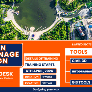
URBAN DRAINAGE DESIGN TRAINING – April 6, 2026 ENROLLMENT
Original price was: $ 200.00.$ 100.00Current price is: $ 100.00. -
Sale!

Advanced Civil 3D Training: At-Grade Intersection Design Course
Original price was: $ 200.00.$ 100.00Current price is: $ 100.00. -
Sale!
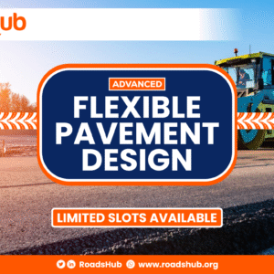
Advanced Flexible Pavement Design Course
Original price was: $ 300.00.$ 200.00Current price is: $ 200.00.
Reviews
There are no reviews yet.